In recent years, the threat of wildfires has loomed large over the Southeast, and a group of dedicated researchers is stepping up to tackle this growing concern. With a focus on community-specific needs, they are crafting innovative tools to better understand and manage wildfire risks. Join us as we explore their inspiring efforts to protect both people and nature.

Wildfire risks in the Southeast are on the rise, driven by factors like climate change and urban expansion into forested areas. In response, dedicated researchers are uniting their expertise to devise strategies for effective fire management. Their mission? To safeguard communities while ensuring the health of our forests.
A collaborative effort led by USDA Forest Service researcher Lars Pomara showcases a brilliant model of teamwork. The heart of this project lies in a working group comprised of fire professionals, researchers, and forest managers, all driven to create actionable solutions. Pomara notes, “We focused on making our findings easily accessible and practical for those out in the field.”
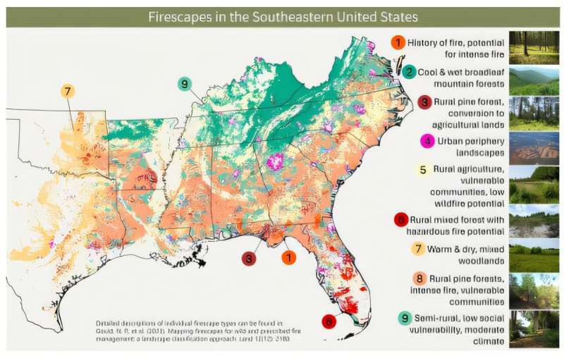
In one detailed study, ORISE researcher Nicholas Gould and his team gathered over 70 datasets related to fire and smoke patterns, social vulnerabilities, and land use, drawing from a variety of reputable sources including NASA and the Centers for Disease Control. This extensive data collection allowed them to create maps reflecting wildfire risks tailored to individual communities, taking into account the varied vulnerabilities that exist.

It’s crucial to recognize that not every community faces the same level of wildfire risk. Vulnerable populations, such as those with disabilities or limited financial resources, need special consideration in evacuation planning and fire response strategies. These insights form the groundwork for a more equitable approach to fire management.
One remarkable aspect of this research is its inclusion of smoke exposure risks fueled by wildfires. Each landscape was carefully examined to understand how smoke might impact populated areas during emergencies, shedding light on a previously overlooked hazard.
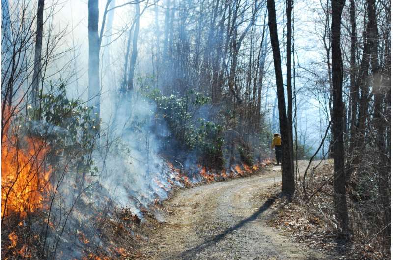
In another collaborative study, researcher Sandhya Nepal evaluated how incorporating controlled burns could significantly reduce wildfire risks. Prescribed fires can clear excess vegetation, thus minimizing fuel for future wildfires. The study revealed surprising patterns: while areas like Florida face the highest fire risks, regions such as the Ozarks and southern Appalachians, known for their cooler and wetter climates, can also benefit from these controlled burns to maintain forest health.
The comprehensive findings from these studies are easily accessible through user-friendly story maps. Developed in partnership with various communities, these tools empower stakeholders to navigate and respond to wildfire risks effectively.
With a deep sense of collaboration at its core, this project emphasizes the importance of open communication beyond academic circles. Pomara expresses pride in how well the research has resonated with the communities involved, illustrating the essence of working together for a safer, more resilient future.
More information:
Story maps
If you would like to see similar science posts like this, click here & share this article with your friends!

